
GeoFS is a flight simulator that boasts a realistic world environment generated from satellite imagery and natural geographical data. It features high-resolution terrain mesh maps, large-scale multiplayer dogfights, and a map navigation system with over 30,000 reference runways.
The software's highlights include global satellite imagery that can be manually or automatically set to day/night cycles, PAPI and runway lights on key runways for approach assistance, and pre-set locations for immediate access to interesting areas. You can also search for any location and place it directly on the map. The map also provides everything needed for navigation, including air routes, traffic, and approximately 30,000 takeoff/approach runways. You can fly to any place in the world.
Nearby and True GeoFS is a truly authentic flight simulator, powered by a realistic game engine. The flight dynamics model is based on physical laws, simulating all the forces acting on the aircraft's surface during flight. The controls and equipment have been simplified to make flying easier, even for those without any experience. Aircraft have been adjusted to match real-life characteristics. The instrumentation is precise and fully functional, with all new GeoFS aircraft featuring virtual cockpits. You can access weather data, process it to convert it into real air conditions at your location, and use the Ridge Lift model for glider soaring training. Some aircraft are equipped with autopilot systems.
Large-Scale Multiplayer Dogfights The large-scale multiplayer dogfights allow you to fly with other pilots. After logging in with your Google account, you can also chat with other pilots. The connected pilots directory provides access to everyone currently flying. You may even encounter real-life commercial traffic. ADS-B transmitter data is obtained and used to populate the GeoFS airspace.
Software Features
GeoFS offers a range of features that enhance the flight simulation experience:
Realistic Weather Simulation: Experience dynamic weather patterns that affect your flight.
Advanced Graphics: High-quality graphics that bring the world to life.
Extensive Aircraft Selection: Choose from a variety of aircraft with different characteristics and capabilities.
Customizable Settings: Tailor your flight experience with adjustable settings for difficulty, controls, and more.
How to Use GeoFS
To get started with GeoFS, follow these simple steps:
Download and install the GeoFS software.
Launch the program and log in with your Google account (if you have one).
Select your aircraft and customize your settings.
Choose your location and start your flight.
Use the map navigation system to explore the world or engage in multiplayer dogfights.
With GeoFS, the sky is not the limit. Experience the thrill of flight in a realistic and immersive environment.


 金字塔决策交易系统64位
 浩辰CAD机械标准版
 帮大家PDF超能助手
 E8财务管理软件增强版
 E8财务管理软件专业版
 证书助手-统计局专版
 冬瓜配音
冬瓜配音
 浩辰CAD建筑
 2K公布免费第三人称英雄射击游戏《Ethos计划》
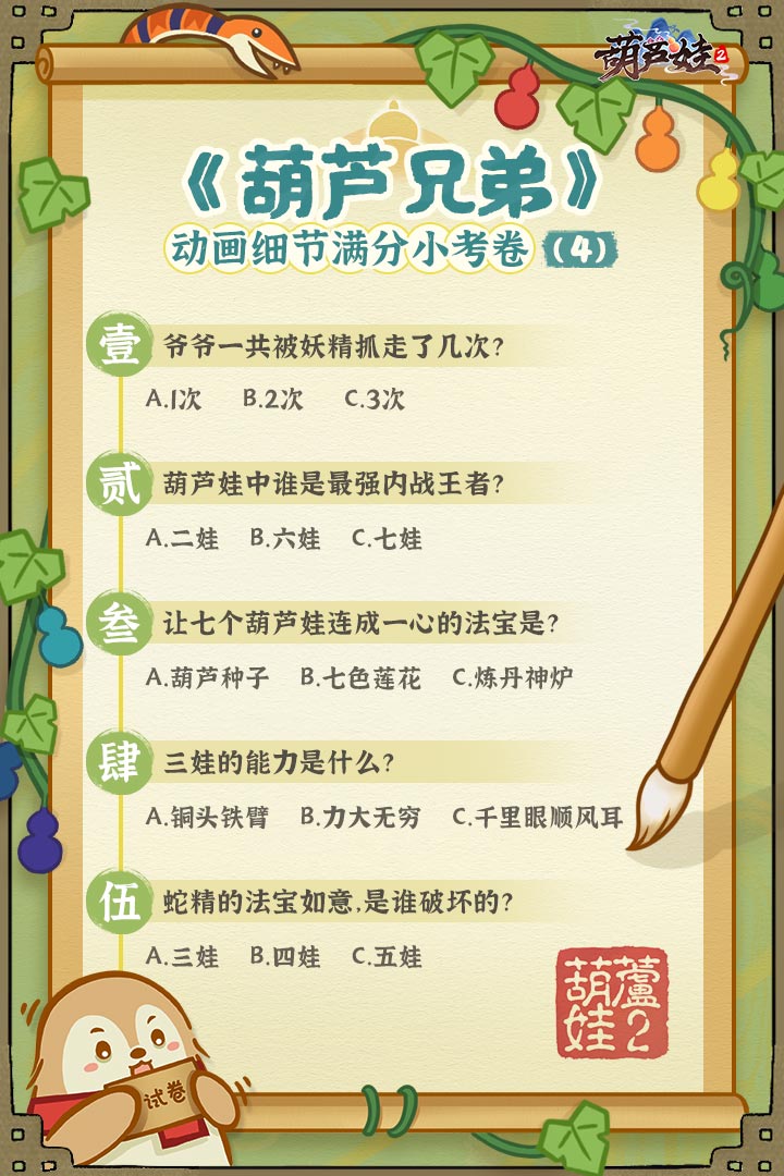 考试啦,《葫芦娃2》带来原动画细节小考卷(4)
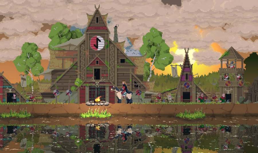 王国两位君主北欧之地隐士有什么用
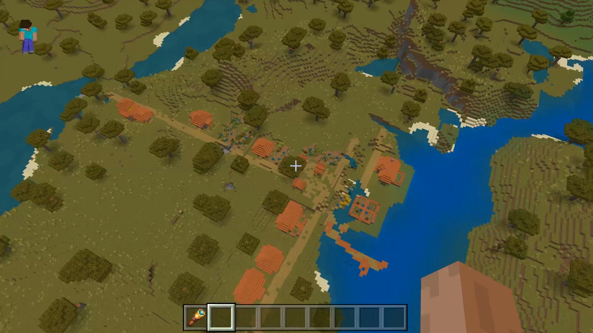 我的世界种子怎么种植方法
 崩坏学园2怎么注销崩坏怎么注销账号
 不止《生化危机》外媒精选30款恐怖佳作
 王国两位君主北欧之地雷神之锤解锁顺序
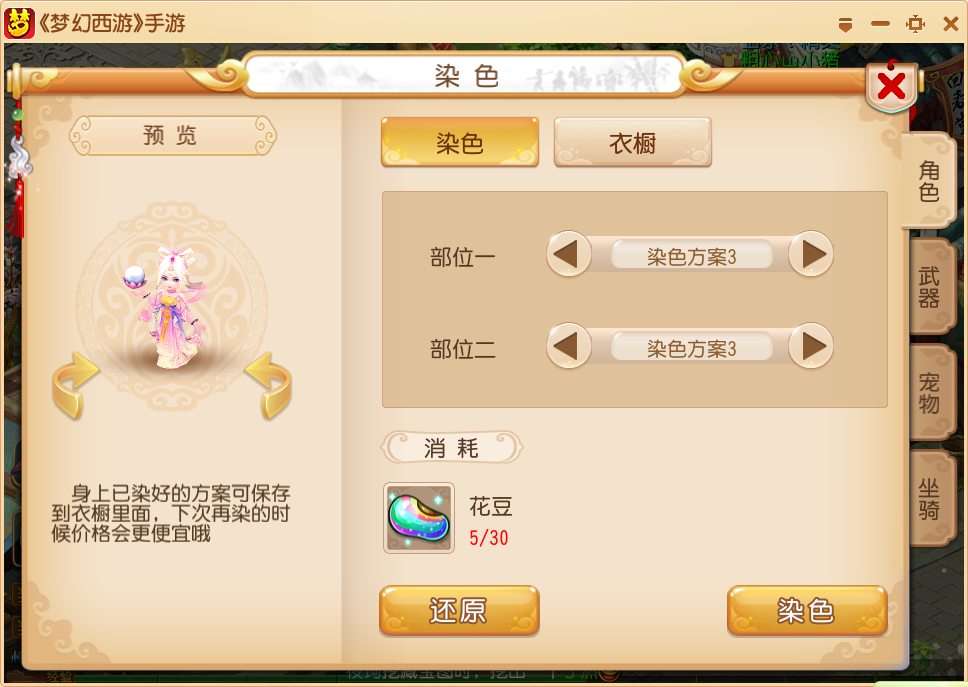 梦幻西游梦玲珑穿什么
 功夫熊猫阿宝邀你切磋,《蛋仔派对》联动KouKouLove第二弹开启
 终结之王SF《街头篮球》提升胜率之失误控制