Altitude Measurement App is an excellent GPS-based real-time altitude measuring software, also known as GPS Altimeter, which accurately and instantly retrieves the altitude of your current location. It is an essential real-time altitude measuring application for outdoor activities.
The software provides robust GPS real-time altitude measurement capabilities, including air oxygen measurement, satellite maps, real-time latitude and longitude display, and a moving compass, making it ideal for outdoor enthusiasts for traveling, hiking, running, off-road driving, skiing, outdoor photography, treasure hunting, camping, and other outdoor activities for altitude recording and reference.
The latest version of the app also allows you to share watermark photos with altitude information with friends in real-time. So, download it now and never get lost during your travels again!
Software Features
1. Altitude Measurement: Real-time altitude measurement without the need for an internet connection, accurately determining the altitude and coordinates of your location.
2. Compass: Built-in compass function to quickly obtain the direction and coordinates of your location.
3. Map Navigation: Supports map viewing, displaying the current coordinates and altitude information on the map.
4. GPS Location: GPS real-time positioning for faster and more accurate altitude measurement information.
5. Outdoor Toolbox: Includes a ruler, noise detector, distance measurement, level, and other rich features.
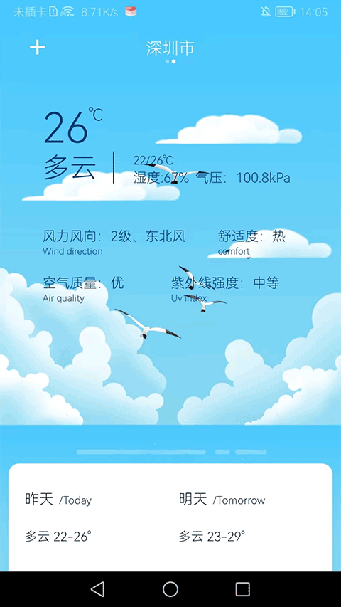
6. Weather Forecast: Supports weather information for all cities, with accurate and comprehensive forecasts, including 24-hour forecasts and future forecasts.
How to Use the Altitude Measurement App
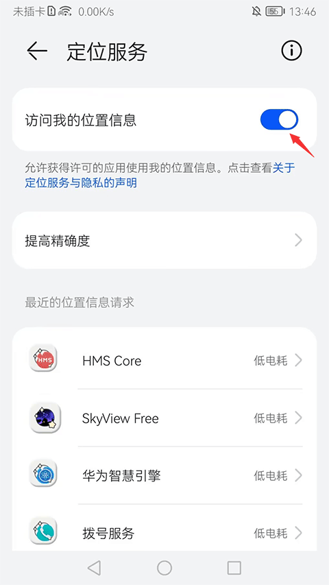
1. Open the GPS Altitude Measurement App. The phone will automatically navigate to the permission settings page. Ensure that location access is enabled.
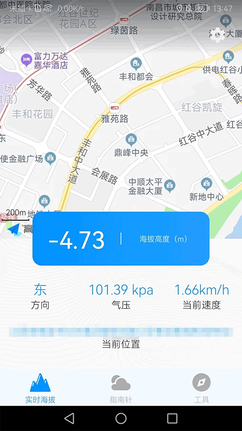
2. Return to the real-time altitude page of the software. You will see detailed information about your current location, direction, and air pressure.
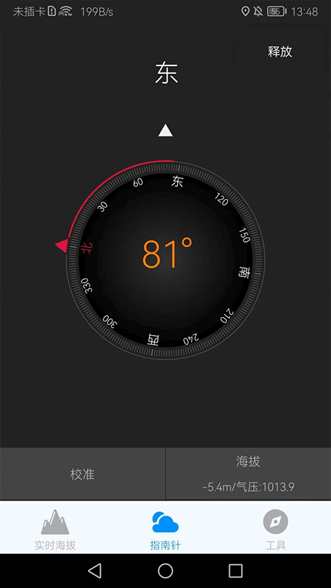
3. The compass will accurately guide you, and altitude and air pressure will be displayed on this page.
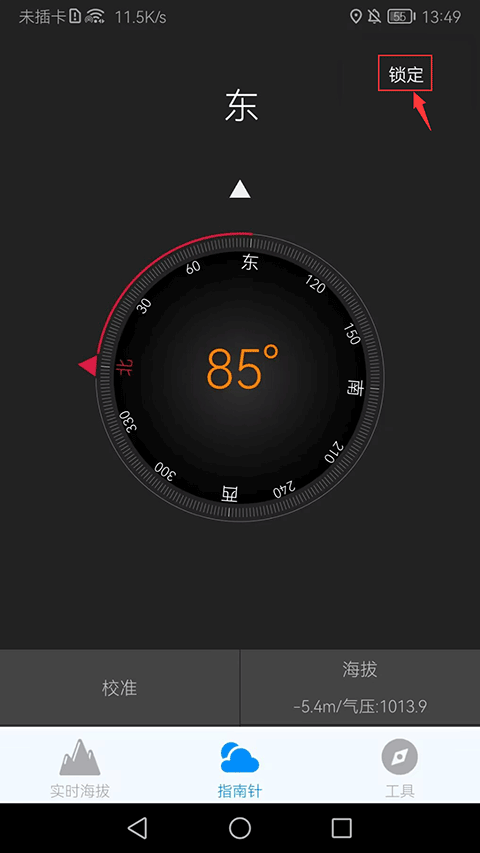
4. The compass's direction changes in real-time based on user movement. If you don't want it to keep moving, you can click the "Lock" button in the top right corner.
5. The software also provides a ruler, decibel meter, flashlight, and weather forecast functions.
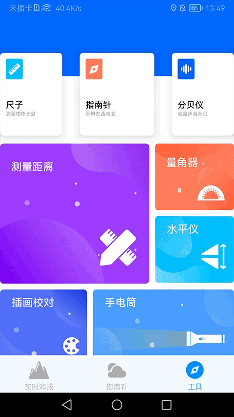
How to Check the Weather Forecast on the Altitude Measurement App
1. Click on "Tools" at the bottom right corner of the software home page.

2. Scroll to the bottom of the screen and click on "Weather Forecast" to check the temperature for the next three days, as well as wind direction, air quality, and other details for the day.
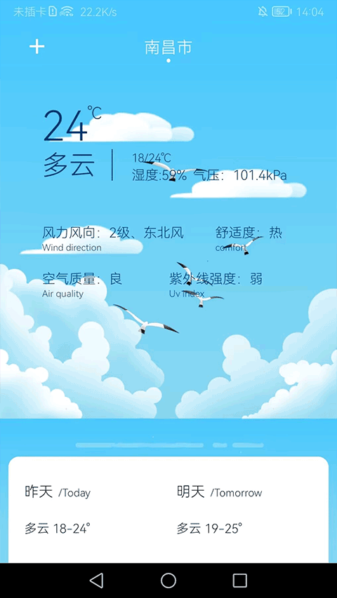
3. To check the weather conditions in your city, click on the "+" sign in the top left corner for city management.
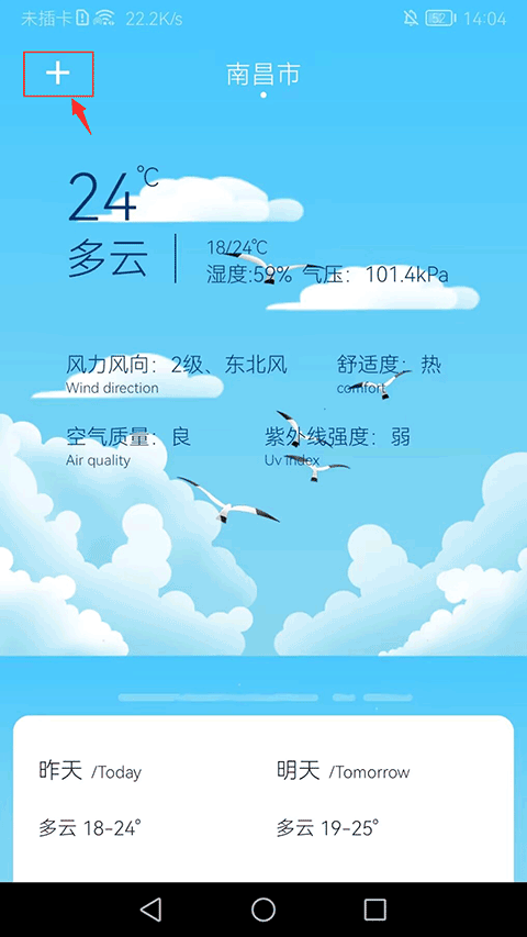
4. In the city management page, click on the "+" sign in the top right corner.

5. Find and click on your city.
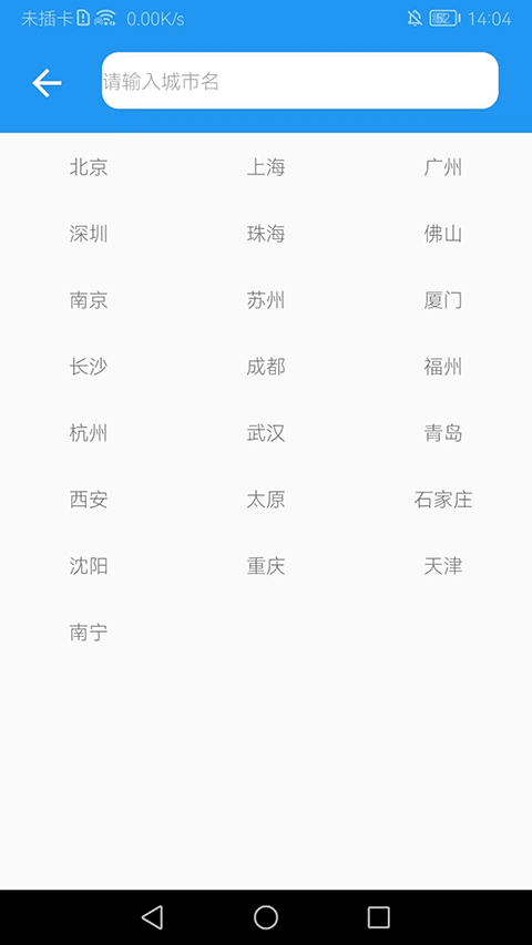
6. Swipe the screen on the weather forecast page to view the weather conditions in your city.
Software Highlights
1. The app features a powerful GPS positioning tool that accurately retrieves your current location and provides latitude and longitude information.
2. It offers online access to weather forecast data for almost all cities in China, providing accurate daily weather forecasts.
3. The compass tool helps users detect the direction of their location and assists in determining orientation.
4. It provides a practical altitude measurement tool that can directly measure altitude, even without an internet connection.
5. The compact and stylish outdoor toolbox allows for easy use, enabling you to travel light without the need for additional tools.
6. The practical map navigation function allows you to view map information at any time, accurately checking your location on the map.
Software Advantages
1. Clean interface, simple operation, easy for users to get started.
2. Comprehensive functions support outdoor activities.
3. GPS positioning can be used without an internet connection, providing greater convenience.
Update Log
v3.6 version
Fix bugs
Enhance stability


 UC浏览器
UC浏览器
 广角助手
广角助手
 简文
简文
 心动日常
心动日常
 优效日历
优效日历
 春安美食
春安美食
 心动日常
心动日常
 多宝古瓷宝典
 2K公布免费第三人称英雄射击游戏《Ethos计划》
 考试啦,《葫芦娃2》带来原动画细节小考卷(4)
 王国两位君主北欧之地隐士有什么用
 我的世界种子怎么种植方法
 崩坏学园2怎么注销崩坏怎么注销账号
 不止《生化危机》外媒精选30款恐怖佳作
 王国两位君主北欧之地雷神之锤解锁顺序
 梦幻西游梦玲珑穿什么
 功夫熊猫阿宝邀你切磋,《蛋仔派对》联动KouKouLove第二弹开启
 终结之王SF《街头篮球》提升胜率之失误控制